Soham has vast and varied experience in the field of photogrammetry having worked on thousands of projects for companies across the globe. Every year, Soham executes a wide range of projects of all sizes ranging from single model, property & parking lot surveys; to full on County wide mapping projects. See below a full list of mapping services we offer.
Aerial Triangulation
AT is the first step in determining the accuracy of a project. Soham is able to perform AT with either Frame based camera images or digital images. We can handle most if not all digital camera formats including drone cameras and do both Manual / Automated point collection depending on your requirements. Over the years we have executed a vast number of projects in AT ranging from Single Model to Very Large Scale projects that have contained even 80,000 frames.

Topography Mapping
Soham is able to delineate highly accurate Topographical details of a given area and generate the best possible contours & elevation models through the careful and meticulous collection of breaklines and mass points. We have experience in generating contours for all intervals from 0.5 feet - 5 feet. We are also having very good experience in working with Hybrid mapping where LiDAR generated DEM is used to generate contours.
Digital Terrain Modelling
Upon collecting the necessary breaklines or mass points Soham can use these to generate highly accurate Digital surface models such as DTM, DEM & TIN so as to give our clients the best possible surface. We are highly experienced in working on all specifications such as USGS, ASPRS, etc.
Planimetric Mapping
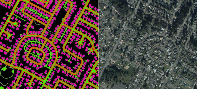
Soham is able to collect all visible planimetric features in stereo with high accuracy. Features include buildings, utilities, hydro, transportation, vegetation, etc.
Over the years, we have worked on all types of planimetric projects at scales ranging from 1:200 to 1:20. We are proficient in working with different specifications such as Engineering grade mapping, AZDOT, CALTRANS, etc.
Utility Mapping
Just as with planimetric, Soham executed numerous Utility mapping projects for cities and counties where all features related to a specific utility were digitized as per the client requirements.
Features such as Sign posts, Traffic Signals, Street lights, Road Lines, Pedestrian Crossings, etc. were digitized for Road corridor projects.
Features including pylons, pylon arms, guy wires, light poles, distribution wires, etc., were digitized for Transmission corridor projects.
2D/3D Impervious Feature Mapping
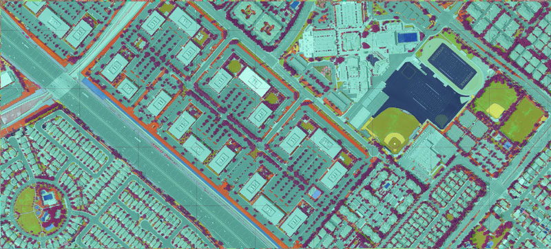
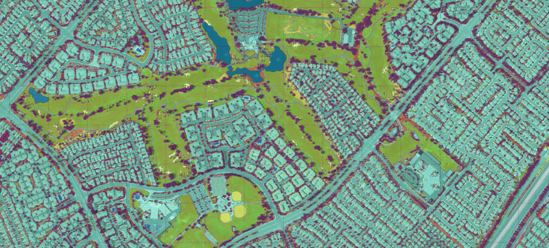
Soham has executed county wide Pervious & Impervious feature mapping projects in both 2D & 3D, where all areas were identified and classified into their respective feature classes. We have handled these projects in all areas ranging from rural to highly dense urban areas.
Engineering Grade Mapping
Especially for Road corridor and Hydrography projects where accuracy requirements are absolute, Soham was able to collect Planimetric features and generate Topographic models with Engineering grade accuracy.
Volumetric/Change Detection Mapping
Soham has immense experience in working on Volumetric Mapping projects and has been executing hundreds of projects every year for mining and landfill companies across the world. We have provided highly accurate Topographical maps that can help determine the change in the volume of materials dumped or excavated in a given area. Not only do we provide highly accurate Topographical maps, we also generate Volumetric reports by comparing two separate datasets for the same area across different time periods.


